Written by Sam Corporations January 26, 2023
The Choquequirao Hike & Ruins are all of the things you want in an archeological site: beautiful, mysterious, extensive, unique, fascinating, etc. They have been classified successively as a fortress, a ceremonial center, a city and the last residence of the Inca. One of the most important aspect is that they were never discovered by the Spanish during the decades of conquest. Despite the conquistadors never finding the citadel, it is very disappointed to hear from local families that it was thoroughly looted throughout the 1900s. However, the site is so massive and so little of it has been properly restored that we don’t really know how much is still covered by the jungle. We also don’t know what will be found when that jungle is removed.
Cradle of Gold
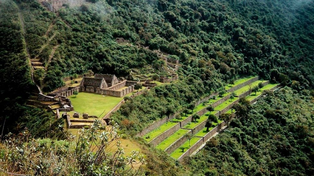
In Quechua, Choquequirao means “cradle of gold” and many theorize that there were gold mines nearby that were exploited during the Incario. However, as with so much Inca history, the original name of the site is still up for debate. (For the record, Machu Picchu is not the original name of that site either). Like all Inca cities, it includes a main plaza, royal quarters for when the Inca visited, a temple for the sun, large buildings called kallankas, storage buildings called collcas, platforms called usnu, barracks for soldiers, a prison, walled-off houses separate from the rest of the site for priests, an administrative center and lots and lots of terraces for agriculture and hillside stabilization.
Like all Andean cities or towns, it is divided into the upper half (hanan) and the lower half (hurin). This is only one of the innumerable examples of the Inca concept of duality. In this case, the hanan (upper part) is more important because that’s where the Inca’s residence is. The residence is easily distinguished by the higher quality of stone work and the channeled water that leads straight to a shower and bath.
Llamas
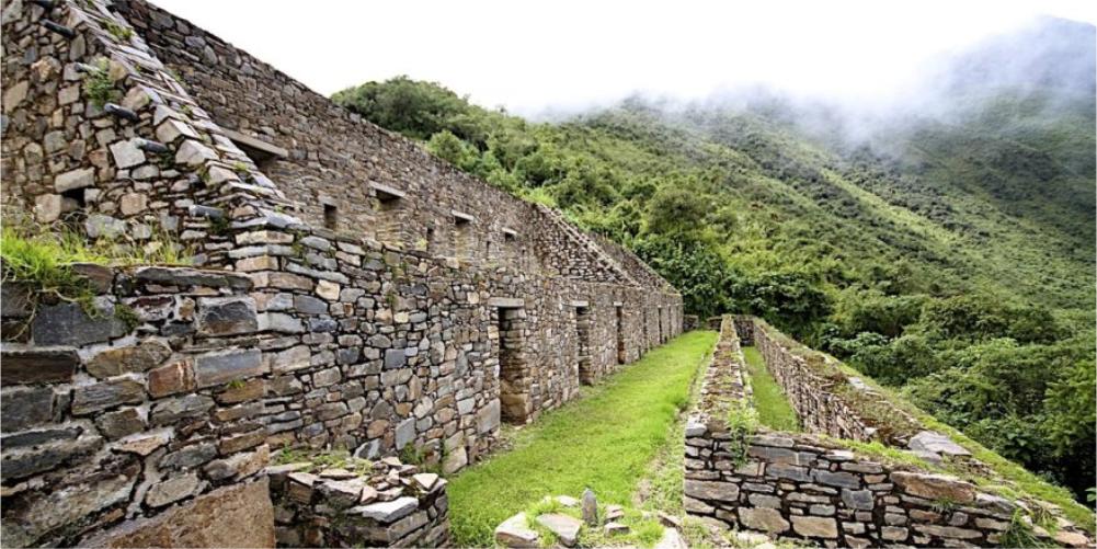
The most famous part of the ruins are terraces with white quartz llamas built into the walls (terraces wall). We know that they’re llamas and not alpacas because they’re too skinny to be alpaca and the elevation of the site is too low for alpaca to be happy there. The elevation of Choquequirao is llama territory.
Archeologists theorize that the entire hillside to the right of what has been restored is covered with terraces, houses and other Inca constructions. It will take an extraordinary amount of time and money to fund restoration of all of Choquequirao.
On your way from Marampata to the ruins, you pass the residences of the Ministry of Culture workers who are still busy clearing jungle and maintaining what has been uncovered. They’re interesting people and if you can catch one taking a bit of a break, take the opportunity to ask them about the ruins and their experiences working there. (Plus sometimes they have cute puppies to play with).
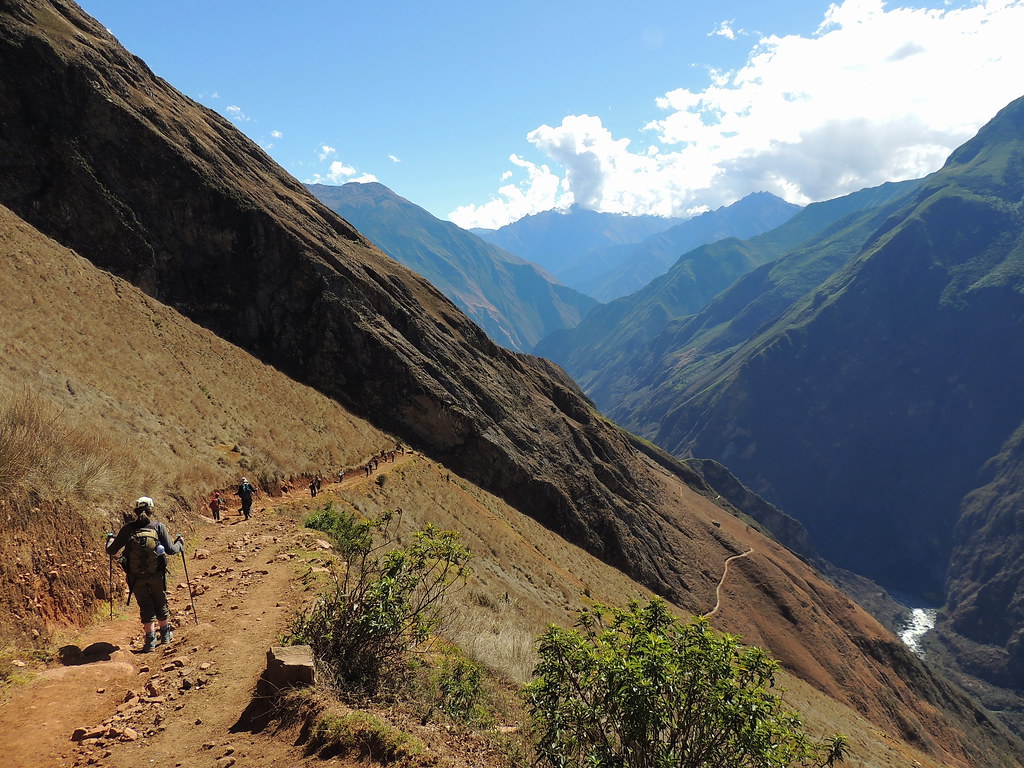
The green area with some houses on the right is Matampata, the closest you can camp (or rent a cabin) to the ruins. On the left you can see the trail zig zag back up to Capuliyoc, which is right in front of a bit of hillside that’s in shadow. Even from this perspective, you still can’t see even halfway down into the vast canyon.
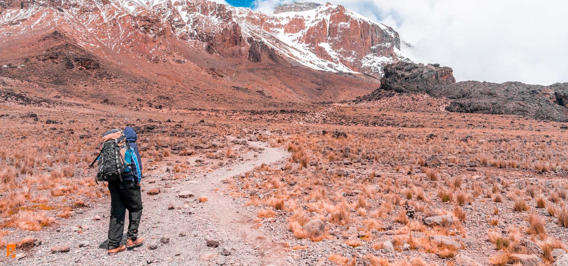
After arriving from Cusco, the only way to reach the trailhead to these ruins is by bus charter or private vehicle. Trekking is the only way to get to Choquequirao, and it’s no simple task. It is recommended that you hire a guide and a few pack mules to carry extra supplies. It takes approximately 2 days of full hiking to get to the archeological site, and 4 days total to complete the trip. The campsites, like the route itself, are well-maintained and equipped with facilities not found on most other Andean trails. The campsites all have running water, showers and toilet blocks, and even small shops selling snacks and drinks.
Best Time to Go:
The best time to do the Choquequirao hike is between May and September. This is the dry season in the Andes, and also when the weather is the most predictable. During the rainy season between October and April often the trail is closed because of unsafe trail conditions and torrential weather.
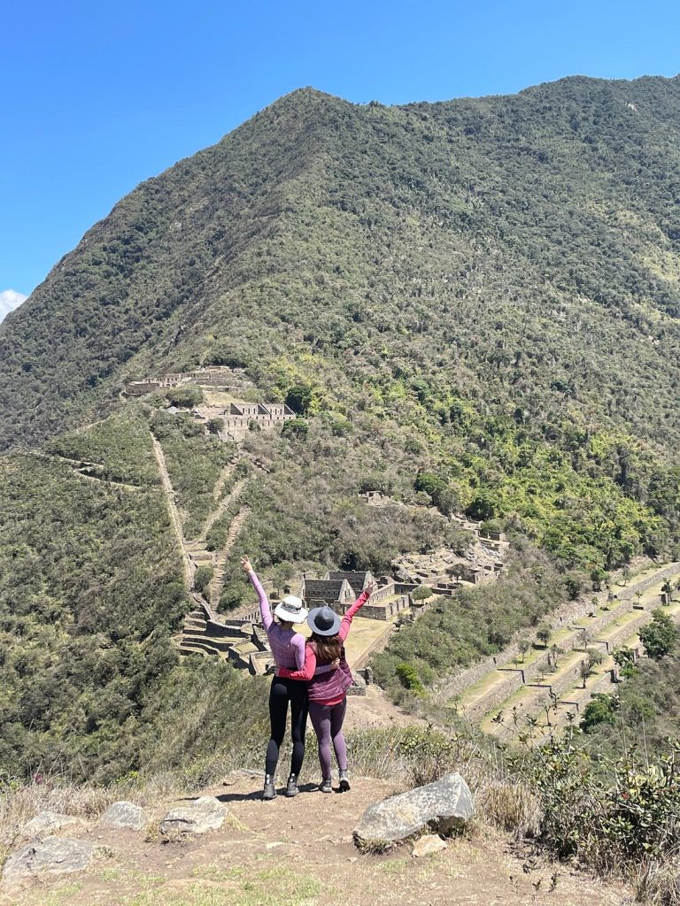
Basically, over the four or five or however many days you take to visit Choquequirao (we recommend 5 days and 4 nights), you will descend and then ascend well over 4,300 meters / 14,100 feet. Where you begin at Capuliyoc, you can clearly see the Choquequirao site and the village of Marampata. That means you start with the descent down to the Apurimac River, followed by the ascent up to Marampata and Choquequirao, then the descent back down to the river and ascent up to Capuliyoc. Not even the trail from Marampata to Choquequirao has any flat sections. It’s a constant descent to the lower terraces of the ruins, from there you will climb up to see the rest of the archeological site.
Early Mornings
Get up early and usually get on the trail by 6:00 a.m. because early in the morning, the canyon is still in shadow. The lower you get into the canyon, the hotter it is, because you’re not too far from the equator and low elevations in the tropics are always hot. There is a lovely afternoon upcanyon wind, but we do not recommend doing much hiking between about 10:00 a.m. and 2:00 p.m.
Our first breakfast was at Capuliyoc and lunch at Chiquiska, both on the side of the river that’s part of the Apurimac region. Once you cross the bridge over the Apurimac River, you enter the Cusco region. This is significant because the Cusco region has a big budget for supporting tourism, while Apurimac does not. The families in the Cusco region have received solar panels, cooking ranges big enough to cook for large groups and even monthly checks or supplies during the worst of the pandemic.
The first day we hiked from Capuliyoc all the way down to the river. Jump in the cold water to rinse off and then hike up to a place called Santa Rosa. This isn’t even big enough to be a village. It’s only one family.
The Second Day
The second day is a little more challenging as it is all uphill. When you get up to Marampata you will stop at the first house. There are plans for a sign at the entrance of the village with names of all of the families offering camping area.
The Third Day
The third day of the Choquequirao Hike is spent all day at the ruins. It’s still a hike from Marampata to Choquequirao, and it’s all a steep descent, which becomes a steep ascent in the afternoon.
The Fourth Day
The fourth day you will walk back down to the Apurimac, and head for a swim before crossing the bridge and hike up to Chiquiska.
The Fifth Day
The fifth day is like the third: all uphill but not too far. You will leave Chiquiska at 6:00 a.m. and arrive at Capuliyoc at 9:00 a.m. Breakfast is at 5:00 a.m. and lunch at Capuliyoc is at 11:00 a.m.
The view from Capuliyoc is breathtaking and worth every step.
Choquequirao Hike information has been updated on June 2023.
Quality
Contact our travel advisors to plan the most complete trip of your life.
Simplified ease of communication, text us on WhatsApp, email or call us.
Our guides are local and have vast knowledge in Peruvian culture and history.
100% local company. Development and environmental sustainability
Our groups never exceed 10 people, giving you an unforgettable experience
Discover an exceptional journey where perfection meets adventure.